


Visit Afrika: Visit Morocco. See Djemaa el-Fna.: Djemaa el-Fna, Marrakesh, MOROCCO Marrakesh is the third largest city in Morocco after Casablanca and the capital city Rabat. The Dj...
Sunday, October 12, 2014
Tuesday, March 12, 2013
THE GREAT PYRAMID OF GIZA, EGYPT
THE ARABS OF EGYPT
 |
| The Great Pyramids at night |
Egypt, officially, the Arab Republic of Egypt, is in north-eastern Africa with its capital located in its largest city, Cairo. Egypt also extends into Asia by virtue of holding the Sinai Peninsula. Egypt is bordered by Israel and the Gaza Strip to the north-east, by Sudan to the south and by Libya to the west. The country is bounded by the Mediterranean and Red Seas (to the north and east respectively) and geographically dominated both by the Nile River and its fertile well-watered valley, and by the Eastern and Western deserts.
Egypt is perhaps best known as the home of the ancient Egyptian civilization, with its temples, hieroglyphs, mummies, and - visible above all - its pyramids. Less well-known is Egypt's medieval heritage, courtesy of Coptic Christianity and Islam - ancient churches, monasteries and mosques punctuate the Egyptian landscape. Egypt stimulates the imagination of western tourists like few other countries and is probably one of the most popular tourist destinations world-wide.
The regularity and richness of the annual Nile River flood, coupled with semi-isolation provided by deserts to the east and west, allowed for the development of one of the world's great civilizations. A unified kingdom arose around 3200 B.C. and a series of dynasties ruled in Egypt for the next three millennia. The last native dynasty fell to the Persians in 341 B.C., who in turn were replaced by the Greeks, Romans, and Byzantines. It was the Arabs who introduced Islam and the Arabic language in the 7th century and who ruled for the next six centuries. A local military caste, the Mamluks, took control about 1250 and continued to govern after the conquest of Egypt by the Ottoman Turks in 1517. Following the completion of the Suez Canal in 1869, Egypt became an important world transportation hub, but also fell heavily into debt. Ostensibly to protect its investments, Britain seized control of Egypt's government in 1882, but nominal allegiance to the Ottoman Empire continued until 1914. Partially independent from the UK in 1922, Egypt acquired full sovereignty following World War II. The completion of the Aswan High Dam in 1971 and the resultant Lake Nasser have altered the time-honored place of the Nile River in agriculture and the ecology of Egypt. A rapidly growing population (the largest in the Arab world), limited arable land, and dependence on the Nile all continue to overtax resources and stress society. The government has struggled to prepare the economy for the new millennium through economic reform and massive investment in communications and physical infrastructure.
 Tourism is Egypt’s second largest source of revenue, bringing in $13 billion in 2010. To visit the Pyramids is to be struck dumb by their monumentality, their celebration of the fundamental human need to create. It's even more affecting in the midst of a revolution, when there are no tourists at all. A week after Hosni Mubarak’s departure and a day after the biggest celebration in Tahrir Square, a handful of Egyptians scrambled up the blocks of Khufu’s Great Pyramid, but there was not a foreigner to be seen.
GIZA NECROPOLIS
The Giza Necropolis, otherwise known as the "Pyramids of Giza" is an archaeological site on the Giza Plateau, on the outskirts of Cairo, Egypt. This complex of ancient monuments includes the three pyramid complexes known as the Great Pyramids, the massive sculpture known as the Great Sphinx, several cemeteries, a workers' village and an industrial complex. It is located some 9 km (5 mi) inland into the desert from the old town of Giza on the Nile, some 25 km (15 mi) southwest of Cairo city centre. The pyramids, which have always loomed large as emblems of ancient Egypt in the Western imagination, were popularised in Hellenistic times, when the Great Pyramid was listed by Antipater of Sidon as one of the Seven Wonders of the World. It is by far the oldest of the ancient Wonders and the only one still in existence.
The Pyramids of Giza consist of the Great Pyramid of Giza (known as the Great Pyramid and the Pyramid of Cheops or Khufu), the somewhat smaller Pyramid of Khafre (or Chephren) a few hundred meters to the south-west, and the relatively modest-sized Pyramid of Menkaure (or Mykerinos) a few hundred meters further south-west. The Great Sphinx lies on the east side of the complex. Current consensus among Egyptologists is that the head of the Great Sphinx is that of Khafre. Along with these major monuments are a number of smaller satellite edifices, known as "queens" pyramids, causeways and valley pyramids.
The Great Pyramid of Giza
The Great Pyramid of Giza is the oldest and largest of the three pyramids in the Giza Necropolis bordering what is now El Giza, Egypt. It is the oldest of the Seven Wonders of the Ancient World, and the only one to remain largely intact. Egyptologists believe that the pyramid was built as a tomb for fourth dynasty Egyptian Pharaoh Khufu (Cheops in Greek) over a 10 to 20-year period concluding around 2560 BCE. Initially at 146.5 metres (481 feet), the Great Pyramid was the tallest man-made structure in the world for over 3,800 years. Originally, the Great Pyramid was covered by casing stones that formed a smooth outer surface; what is seen today is the underlying core structure. Some of the casing stones that once covered the structure can still be seen around the base. There have been varying scientific and alternative theories about the Great Pyramid's construction techniques. Most accepted construction hypotheses are based on the idea that it was built by moving huge stones from a quarry and dragging and lifting them into place.
 |
| Khufu Pyramid |
There are three known chambers inside the Great Pyramid. The lowest chamber is cut into the bedrock upon which the pyramid was built and was unfinished. The so-called Queen's Chamber and King's Chamber are higher up within the pyramid structure. The Great Pyramid of Giza is the only pyramid in Egypt known to contain both ascending and descending passages. The main part of the Giza complex is a setting of buildings that included two mortuary temples in honor of Khufu (one close to the pyramid and one near the Nile), three smaller pyramids for Khufu's wives, an even smaller "satellite" pyramid, a raised causeway connecting the two temples, and small mastaba tombs surrounding the pyramid for nobles.
Khufu’s pyramid complex consists of a Valley Temple, now buried beneath the village of Nazlet el-Samman; basalt paving and nummulitic limestone walls have been found but the site has not been excavated. The Valley Temple was connected to a causeway which was largely destroyed when the village was constructed. The Causeway led to the Mortuary Temple of Khufu. From this temple only the basalt pavement remains. The mortuary temple was connected to the king’s pyramid. The king’s pyramid has three smaller queen’s pyramids associated with it and five boat pits. The boat pits contain a ship, and the two pits on the south side of the pyramid still contained intact ships. One of these ships has been restored and is on display. Khufu's Pyramid maintains a limited collection of casing stones at its base. These casing stones were made of fine white limestone quarried from the nearby range.
Khafre’s Pyramid Complex
Khafre's pyramid complex consists of a Valley temple (sometimes referred to as the Sphinx temple), a causeway, a mortuary temple and the king’s pyramid. The Valley Temple yielded several statues of Khafre. Several were found in a well in the floor of the temple by Mariette in 1860. Others were found during successive excavations by Sieglin (1909–10), Junker, Reisner, and Hassan. Khafre’s complex contained five boat-pits and a subsidiary pyramid with a serdab. Khafre's Pyramid appears larger than the adjacent Khufu Pyramid by virtue of its more elevated location, and the steeper angle of inclination of its construction – it is, in fact, smaller in both height and volume. Khafre's Pyramid retains a prominent display of casing stones at its apex.
.jpg) |
| Khafre Pyramid |
Menkaure's Pyramid Complex
Menkaure’s pyramid complex consists of a Valley Temple, a causeway, a mortuary temple, and the king’s pyramid. The Valley Temple contained several statues of Menkaure. During the 5th dynasty, a smaller ante-temple was added on to the Valley temple. The Mortuary temple also yielded several statues of Menkaure. The king’s pyramid has three subsidiary or Queen’s pyramids. Of the four major monuments, only Menkaure's Pyramid is seen today without any of its original polished limestone casing.
 |
| Menkaure Pyramid |
The Sphinx
The Sphinx dates to the reign of King Khafre. A chapel was located between its forepaws that had unfortunate history of being repeatedly destroyed by unusual circumstances. During the New Kingdom, Amenhotep II dedicated a new temple to Hauron-Haremakhet and this structure was added onto by later rulers.
 |
| The Great Sphinx |
Visitors will need a passport for this trip. First time applicants will pay $100 per adult and $85 per child under age 16. Thirty-day tourist visas are available at Egypt airports for $15. Packing for Cairo may send would-be travelers shopping. In addition to the hot-weather vacation standards of a hat, comfy shoes and sunglasses, female travelers will need to pay extra attention to their wardrobe. Egyptian tourism officials advise women to conform to the local views of modesty by avoiding shorts and low-cut shirts. They suggest wearing loose-fitting clothes with long sleeves
The best time to visit Egypt weather-wise is from September to November. Bargain hunters can find better airline and hotel rates from June to August, but they’ll also probably encounter 113-degree days. In March and April, high winds may kick up sand and affect visibility.
Acknowledgement: Wikitravel, What It Costs, National Geographic Channel and Wikipedia
You can see our other blogs at Travelogue™ and Nollytube TV™
Sunday, March 3, 2013
VISIT EGYPT. SEE THE PYRAMIDS
THE ARABS OF EGYPT
|
| The Great Pyramids at night |
Egypt, officially, the Arab Republic of Egypt, is in north-eastern Africa with its capital located in its largest city, Cairo. Egypt also extends into Asia by virtue of holding the Sinai Peninsula. Egypt is bordered by Israel and the Gaza Strip to the north-east, by Sudan to the south and by Libya to the west. The country is bounded by the Mediterranean and Red Seas (to the north and east respectively) and geographically dominated both by the Nile River and its fertile well-watered valley, and by the Eastern and Western deserts.
Egypt is perhaps best known as the home of the ancient Egyptian civilization, with its temples, hieroglyphs, mummies, and - visible above all - its pyramids. Less well-known is Egypt's medieval heritage, courtesy of Coptic Christianity and Islam - ancient churches, monasteries and mosques punctuate the Egyptian landscape. Egypt stimulates the imagination of western tourists like few other countries and is probably one of the most popular tourist destinations world-wide.
The regularity and richness of the annual Nile River flood, coupled with semi-isolation provided by deserts to the east and west, allowed for the development of one of the world's great civilizations. A unified kingdom arose around 3200 B.C. and a series of dynasties ruled in Egypt for the next three millennia. The last native dynasty fell to the Persians in 341 B.C., who in turn were replaced by the Greeks, Romans, and Byzantines. It was the Arabs who introduced Islam and the Arabic language in the 7th century and who ruled for the next six centuries. A local military caste, the Mamluks, took control about 1250 and continued to govern after the conquest of Egypt by the Ottoman Turks in 1517. Following the completion of the Suez Canal in 1869, Egypt became an important world transportation hub, but also fell heavily into debt. Ostensibly to protect its investments, Britain seized control of Egypt's government in 1882, but nominal allegiance to the Ottoman Empire continued until 1914. Partially independent from the UK in 1922, Egypt acquired full sovereignty following World War II. The completion of the Aswan High Dam in 1971 and the resultant Lake Nasser have altered the time-honored place of the Nile River in agriculture and the ecology of Egypt. A rapidly growing population (the largest in the Arab world), limited arable land, and dependence on the Nile all continue to overtax resources and stress society. The government has struggled to prepare the economy for the new millennium through economic reform and massive investment in communications and physical infrastructure.
Tourism is Egypt’s second largest source of revenue, bringing in $13 billion in 2010. To visit the Pyramids is to be struck dumb by their monumentality, their celebration of the fundamental human need to create. It's even more affecting in the midst of a revolution, when there are no tourists at all. A week after Hosni Mubarak’s departure and a day after the biggest celebration in Tahrir Square, a handful of Egyptians scrambled up the blocks of Khufu’s Great Pyramid, but there was not a foreigner to be seen.GIZA NECROPOLIS
The Giza Necropolis, otherwise known as the "Pyramids of Giza" is an archaeological site on the Giza Plateau, on the outskirts of Cairo, Egypt. This complex of ancient monuments includes the three pyramid complexes known as the Great Pyramids, the massive sculpture known as the Great Sphinx, several cemeteries, a workers' village and an industrial complex. It is located some 9 km (5 mi) inland into the desert from the old town of Giza on the Nile, some 25 km (15 mi) southwest of Cairo city centre. The pyramids, which have always loomed large as emblems of ancient Egypt in the Western imagination, were popularised in Hellenistic times, when the Great Pyramid was listed by Antipater of Sidon as one of the Seven Wonders of the World. It is by far the oldest of the ancient Wonders and the only one still in existence.
The Pyramids of Giza consist of the Great Pyramid of Giza (known as the Great Pyramid and the Pyramid of Cheops or Khufu), the somewhat smaller Pyramid of Khafre (or Chephren) a few hundred meters to the south-west, and the relatively modest-sized Pyramid of Menkaure (or Mykerinos) a few hundred meters further south-west. The Great Sphinx lies on the east side of the complex. Current consensus among Egyptologists is that the head of the Great Sphinx is that of Khafre. Along with these major monuments are a number of smaller satellite edifices, known as "queens" pyramids, causeways and valley pyramids.
The Great Pyramid of Giza
The Great Pyramid of Giza is the oldest and largest of the three pyramids in the Giza Necropolis bordering what is now El Giza, Egypt. It is the oldest of the Seven Wonders of the Ancient World, and the only one to remain largely intact. Egyptologists believe that the pyramid was built as a tomb for fourth dynasty Egyptian Pharaoh Khufu (Cheops in Greek) over a 10 to 20-year period concluding around 2560 BCE. Initially at 146.5 metres (481 feet), the Great Pyramid was the tallest man-made structure in the world for over 3,800 years. Originally, the Great Pyramid was covered by casing stones that formed a smooth outer surface; what is seen today is the underlying core structure. Some of the casing stones that once covered the structure can still be seen around the base. There have been varying scientific and alternative theories about the Great Pyramid's construction techniques. Most accepted construction hypotheses are based on the idea that it was built by moving huge stones from a quarry and dragging and lifting them into place.
|
| Khufu Pyramid |
There are three known chambers inside the Great Pyramid. The lowest chamber is cut into the bedrock upon which the pyramid was built and was unfinished. The so-called Queen's Chamber and King's Chamber are higher up within the pyramid structure. The Great Pyramid of Giza is the only pyramid in Egypt known to contain both ascending and descending passages. The main part of the Giza complex is a setting of buildings that included two mortuary temples in honor of Khufu (one close to the pyramid and one near the Nile), three smaller pyramids for Khufu's wives, an even smaller "satellite" pyramid, a raised causeway connecting the two temples, and small mastaba tombs surrounding the pyramid for nobles.
Khufu’s pyramid complex consists of a Valley Temple, now buried beneath the village of Nazlet el-Samman; basalt paving and nummulitic limestone walls have been found but the site has not been excavated. The Valley Temple was connected to a causeway which was largely destroyed when the village was constructed. The Causeway led to the Mortuary Temple of Khufu. From this temple only the basalt pavement remains. The mortuary temple was connected to the king’s pyramid. The king’s pyramid has three smaller queen’s pyramids associated with it and five boat pits. The boat pits contain a ship, and the two pits on the south side of the pyramid still contained intact ships. One of these ships has been restored and is on display. Khufu's Pyramid maintains a limited collection of casing stones at its base. These casing stones were made of fine white limestone quarried from the nearby range.
Khafre’s Pyramid Complex
Khafre's pyramid complex consists of a Valley temple (sometimes referred to as the Sphinx temple), a causeway, a mortuary temple and the king’s pyramid. The Valley Temple yielded several statues of Khafre. Several were found in a well in the floor of the temple by Mariette in 1860. Others were found during successive excavations by Sieglin (1909–10), Junker, Reisner, and Hassan. Khafre’s complex contained five boat-pits and a subsidiary pyramid with a serdab. Khafre's Pyramid appears larger than the adjacent Khufu Pyramid by virtue of its more elevated location, and the steeper angle of inclination of its construction – it is, in fact, smaller in both height and volume. Khafre's Pyramid retains a prominent display of casing stones at its apex.
|
| Khafre Pyramid |
Menkaure's Pyramid Complex
Menkaure’s pyramid complex consists of a Valley Temple, a causeway, a mortuary temple, and the king’s pyramid. The Valley Temple contained several statues of Menkaure. During the 5th dynasty, a smaller ante-temple was added on to the Valley temple. The Mortuary temple also yielded several statues of Menkaure. The king’s pyramid has three subsidiary or Queen’s pyramids. Of the four major monuments, only Menkaure's Pyramid is seen today without any of its original polished limestone casing.
|
| Menkaure Pyramid |
The Sphinx
The Sphinx dates to the reign of King Khafre. A chapel was located between its forepaws that had unfortunate history of being repeatedly destroyed by unusual circumstances. During the New Kingdom, Amenhotep II dedicated a new temple to Hauron-Haremakhet and this structure was added onto by later rulers.
|
| The Great Sphinx |
Visitors will need a passport for this trip. First time applicants will pay $100 per adult and $85 per child under age 16. Thirty-day tourist visas are available at Egypt airports for $15. Packing for Cairo may send would-be travelers shopping. In addition to the hot-weather vacation standards of a hat, comfy shoes and sunglasses, female travelers will need to pay extra attention to their wardrobe. Egyptian tourism officials advise women to conform to the local views of modesty by avoiding shorts and low-cut shirts. They suggest wearing loose-fitting clothes with long sleeves
The best time to visit Egypt weather-wise is from September to November. Bargain hunters can find better airline and hotel rates from June to August, but they’ll also probably encounter 113-degree days. In March and April, high winds may kick up sand and affect visibility.
Saturday, March 2, 2013
MASAI MARA GAMES RESERVE, MASAI, KENYA
THE MASAI MARA PEOPLE
 |
| Masai Men on the Masai Beach |
According to their own oral history, the Maasai originated from the lower Nile valley north of Lake Turkana (Northwest Kenya) and began migrating south around the 15th century, arriving in a long trunk of land stretching from what is now northern Kenya to what is now central Tanzania between the 17th and late 18th century. Many ethnic groups that had already formed settlements in the region were forcibly displaced by the incoming Maasai, while other, mainly southern Cushitic groups, were assimilated into Maasai society. The resulting mixture of Nilotic and Cushitic populations also produced the Kalenjin and Samburu.
 |
| Sunset at the Masai Mara National Reserve |
The Maasai territory reached its largest size in the mid-19th century, and covered almost all of the Great Rift Valley and adjacent lands from Mount Marsabit in the north to Dodoma in the south. At this time the Maasai, as well as the larger Nilotic group they were part of, raised cattle as far east as the Tanga coast in Tanganyika (now mainland Tanzania). Raiders used spears and shields, but were most feared for throwing clubs (orinka) which could be accurately thrown from up to 70 paces (appx. 100 metres). In 1852, there was a report of a concentration of 800 Maasai warriors on the move in what is now Kenya. In 1857, after having depopulated the "Wakuafi wilderness" in what is now southeastern Kenya, Maasai warriors threatened Mombasa on the Kenyan coast.
The Maasai society is comprised of sixteen sections (known in Maasai as Iloshon): Ildamat, Ilpurko, Ilkeekonyokie, Iloitai, Ilkaputiei, Ilkankere, Isiria, Ilmoitanik, Iloodokilani, Iloitokitoki, Ilarusa, Ilmatatapato, Ilwuasinkishu, Kore, Parakuyu, and Ilkisonko, also known as Isikirari (Tanzania's Maasai). There was also once Iltorobo section but was assimilated by other sections. A majority of the Maasai population lives in Kenya. Sections such as Isikirari, Parakuyu, Kore and Ilarusa lives in Tanganyika.
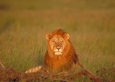 |
| A lion at the Masai National Reserve |
The Maasai are a semi-nomadic people who lived under a communal land management system. The movement of livestock is based on seasonal rotation. Contrary to many claims made by outsiders, particularly the Hardinian school of thought, this communal land management system allows us to utilize resources in a sustainable manner. Each section manages its own territory. Under normal conditions, reserve pastures are fallowed and guarded by the warriors. However, if the dry season becomes especially harsh, sections boundaries are ignored and people graze animals throughout the land until the rainy season arrives. According to Maasai traditional land agreement, no one should be denied access to natural resources such as water and land.
 |
| Tourists being entertained by a Jagu |
MASAI MARA NATIONAL RESERVE
The Masai Mara is one of the best known and most popular reserves in the whole of Africa. At times and in certain places it can get a little overrun with tourist minibuses, but there is something so special about it that it tempts you back time and again.
The Masai Mara lies in the Great Rift Valley, which is a fault line some 3,500 miles (5,600km) long, from Ethiopia's Red Sea through Kenya, Tanzania, Malawi and into Mozambique. Here the valley is wide and a towering escarpment can be seen in the hazy distance. Most of the game viewing activities occur on the valley floor, but some lodges conduct walking tours outside the park boundaries in the hills of the Oloololo Escarpment. The animals are also at liberty to move outside the park into huge areas known as 'dispersal areas'. There can be as much wildlife roaming outside the park as inside. Many Masai villages are located in the 'dispersal areas' and they have, over centuries, developed a synergetic relationship with the wildlife. There are four main types of topography in the Mara: Ngama Hills to the east with sandy soil and leafy bushes liked by black rhino; Oloololo Escarpment forming the western boundary and rising to a magnificent plateau; Mara Triangle bordering the Mara River with lush grassland and acacia woodlands supporting masses of game especially migrating wildebeest; Central Plains forming the largest part of the reserve, with scattered bushes and boulders on rolling grasslands favoured by the plains game. ANIMALS & BIRDS In a short stay during the wildebeest migration you could see thousands of animals, at other times there are still hundreds. The plains are full of wildebeest, zebra, impala, topi, giraffe, Thomson's gazelle. Also regularly seen are leopards, lions, hyenas, cheetah, jackal and bat-eared foxes. Black rhino are a little shy and hard to spot but are often seen at a distance.
SEASONS Altitude is 4,875-7,052 feet (1,500-2,170 metres) above sea level, which yields a climate somewhat milder and damper than other regions. The daytime rarely exceeds 85°F (30°C) during the day and hardly ever drops below 60°F (15°C) at night. Rainy Season: It rains in April and May and again November and this can cause some areas of the Mara to be inaccessible due to the sticky 'black cotton' mud. Dry Season: July to October is dry and the grass is long and lush after the rains. This is a good time to come and see the huge herds of migratory herbivores. Hottest time: The warmest time of year is December and January. Coldest Time: June and July are the coldest months. MASAI MARA SPECIALITIES
· Hot Air Ballooning · Huge savannahs of golden grasslands · Big skies · Rift Valley escarpment · Lion sightings FACTS This is a malarial area The reserve covers an area of 1,510 km² There is no night driving and vehicles must be back at the lodge by 6pm. Several lodges are located outside the park's boundaries, but as there are few fences you may not be aware of this. This is a Reserve rather than a National Park and it belongs to the Masai people. Acknowledgement: Game Reserve, Maasai Mara, Maasai Association, Journey Mart and Wikipedia |


VISIT KENYA: SEE MASAI MARA NATIONAL RESERVE
THE MASAI MARA PEOPLE
The Maasai territory reached its largest size in the mid-19th century, and covered almost all of the Great Rift Valley and adjacent lands from Mount Marsabit in the north to Dodoma in the south. At this time the Maasai, as well as the larger Nilotic group they were part of, raised cattle as far east as the Tanga coast in Tanganyika (now mainland Tanzania). Raiders used spears and shields, but were most feared for throwing clubs (orinka) which could be accurately thrown from up to 70 paces (appx. 100 metres). In 1852, there was a report of a concentration of 800 Maasai warriors on the move in what is now Kenya. In 1857, after having depopulated the "Wakuafi wilderness" in what is now southeastern Kenya, Maasai warriors threatened Mombasa on the Kenyan coast.
The Maasai live in Kraals arranged in a circular fashion. The fence around the kraal is made of acacia thorns, which prevent lions from attacking the cattle. It is a man's responsibility to fence the kraal. While women construct the houses. Traditionally, kraals are shared by an extended family. However, due to the new land management system in the Maasai region, it is not uncommon to see a kraal occupied by a single family.
The Maasai are a semi-nomadic people who lived under a communal land management system. The movement of livestock is based on seasonal rotation. Contrary to many claims made by outsiders, particularly the Hardinian school of thought, this communal land management system allows us to utilize resources in a sustainable manner. Each section manages its own territory. Under normal conditions, reserve pastures are fallowed and guarded by the warriors. However, if the dry season becomes especially harsh, sections boundaries are ignored and people graze animals throughout the land until the rainy season arrives. According to Maasai traditional land agreement, no one should be denied access to natural resources such as water and land.
The Maasai are a Nilotic group inhabiting the African Great Lakes region. Nilotes speak Nilo-Saharan language, and came to Eastern Africa by way ofSouth Sudan. Most Nilotes in the area, including the Maasai, the Samburu and the Kalenjin, are pastoralists, and are famous for their fearsome reputations as warriors and cattle-rustlers. As with the Bantu, the Maasai and other Nilotes in Eastern Africa have adopted many customs and practices from the neighboring Cushitic groups, including the age set system of social organization, circumcision, and vocabulary terms.
|
| Sunset at the Masai Mara National Reserve |
The Maasai people of East Africa live in southern Kenya and northern Tanzania along the Great Rift Valley on semi-arid and arid lands. The Maasai occupy a total land area of 160,000 square kilometers with a population of approximately one half million people. However, many Maasai see the national census as government meddling and often miscount their numbers to census takers.
According to their own oral history, the Maasai originated from the lower Nile valley north of Lake Turkana (Northwest Kenya) and began migrating south around the 15th century, arriving in a long trunk of land stretching from what is now northern Kenya to what is now central Tanzania between the 17th and late 18th century. Many ethnic groups that had already formed settlements in the region were forcibly displaced by the incoming Maasai, while other, mainly southern Cushitic groups, were assimilated into Maasai society. The resulting mixture of Nilotic and Cushitic populations also produced the Kalenjin and Samburu.
 |
| Masai tribal m |
The Maasai society is comprised of sixteen sections (known in Maasai as Iloshon): Ildamat, Ilpurko, Ilkeekonyokie, Iloitai, Ilkaputiei, Ilkankere, Isiria, Ilmoitanik, Iloodokilani, Iloitokitoki, Ilarusa, Ilmatatapato, Ilwuasinkishu, Kore, Parakuyu, and Ilkisonko, also known as Isikirari (Tanzania's Maasai). There was also once Iltorobo section but was assimilated by other sections. A majority of the Maasai population lives in Kenya. Sections such as Isikirari, Parakuyu, Kore and Ilarusa lives in Tanganyika.
|
| A lion at the Masai National Reserve |
The Inkajijik (maasai word for a house) are loaf-shaped and made of mud, sticks, grass, cow dung and cow's urine. Women are responsible for making the houses as well as supplying water, collecting firewood, milking cattle and cooking for the family. Warriors are in charge security while boys are responsible for herding livestock. During the drought season, both warriors and boys assume the responsibility for herding livestock. The elders are directors and advisors for day-to-day activities. Every morning before livestock leave to graze, an elder who is the head of the inkang sits on his chair and announces the schedule for everyone to follow.
 |
| Zebras at the National Reserve |
Maasai society is strongly patriarchal in nature, with elder men, sometimes joined by retired elders, deciding most major matters for each Maasai group. A full body of oral law covers many aspects of behaviour. Formal execution is unknown, and normally payment in cattle will settle matters. An out-of-court process is also practiced called 'amitu', 'to make peace', or 'arop', which involves a substantial apology. The Maasai aremonotheistic, worshipping a single deity called Enkai or Engai. Engai has a dual nature: Engai Narok (Black God) is benevolent, and Engai Nanyokie (Red God) is vengeful. The "Mountain of God", Ol Doinyo Lengai, is located in northernmost Tanzania. The central human figure in the Maasai religious system is the laibon whose roles include shamanistic healing, divination and prophecy, and ensuring success in war or adequate rainfall. Whatever power an individual laibon had was a function of personality rather than position. Many Maasai have become Christian, and to a lesser extent, Muslim. The Maasai are known for their intricate jewelry.
MASAI MARA NATIONAL RESERVE
The Masai Mara is one of the best known and most popular reserves in the whole of Africa. At times and in certain places it can get a little overrun with tourist minibuses, but there is something so special about it that it tempts you back time and again.
Seasoned safari travellers, travel writers, documentary makers and researchers often admit that the Masai Mara is one of their favourite places. So why is that? Perhaps it is because of the 'big skies', the open savannahs, the romance of films like 'Out of Africa' and certainly because of the annual wildebeest migration, the density of game, the variety of birdlife and the chance of a hot air balloon ride. A combination of all these things plus something to do with the spirit of the place - which is hard to put into words - is what attracts people to the Mara over and over.
The Masai Mara lies in the Great Rift Valley, which is a fault line some 3,500 miles (5,600km) long, from Ethiopia's Red Sea through Kenya, Tanzania, Malawi and into Mozambique. Here the valley is wide and a towering escarpment can be seen in the hazy distance. Most of the game viewing activities occur on the valley floor, but some lodges conduct walking tours outside the park boundaries in the hills of the Oloololo Escarpment. The animals are also at liberty to move outside the park into huge areas known as 'dispersal areas'. There can be as much wildlife roaming outside the park as inside. Many Masai villages are located in the 'dispersal areas' and they have, over centuries, developed a synergetic relationship with the wildlife.
There are four main types of topography in the Mara: Ngama Hills to the east with sandy soil and leafy bushes liked by black rhino; Oloololo Escarpment forming the western boundary and rising to a magnificent plateau; Mara Triangle bordering the Mara River with lush grassland and acacia woodlands supporting masses of game especially migrating wildebeest; Central Plains forming the largest part of the reserve, with scattered bushes and boulders on rolling grasslands favoured by the plains game.
ANIMALS & BIRDS
In a short stay during the wildebeest migration you could see thousands of animals, at other times there are still hundreds. The plains are full of wildebeest, zebra, impala, topi, giraffe, Thomson's gazelle. Also regularly seen are leopards, lions, hyenas, cheetah, jackal and bat-eared foxes. Black rhino are a little shy and hard to spot but are often seen at a distance.
Every July (or sometimes August), the wildebeest travel over 600 miles (960km) from Tanzania's Serengeti plains, northwards to the Masai Mara and the Mara River is the final obstacle. In October or November, once they have feasted and the grass has all but gone, they turn around and go back the other way.
The Mara birds come in every size and colour including common but beautiful ones like the lilac breasted roller and plenty of large species like eagles, vultures and storks. There are 53 different birds of prey.
SEASONS
Altitude is 4,875-7,052 feet (1,500-2,170 metres) above sea level, which yields a climate somewhat milder and damper than other regions. The daytime rarely exceeds 85°F (30°C) during the day and hardly ever drops below 60°F (15°C) at night. Rainy Season: It rains in April and May and again November and this can cause some areas of the Mara to be inaccessible due to the sticky 'black cotton' mud. Dry Season: July to October is dry and the grass is long and lush after the rains. This is a good time to come and see the huge herds of migratory herbivores. Hottest time: The warmest time of year is December and January. Coldest Time: June and July are the coldest months. MASAI MARA SPECIALITIES · Wildebeest Migration · Hot Air Ballooning · Huge savannahs of golden grasslands · Big skies · Rift Valley escarpment · Lion sightings
FACTS
This is a malarial area The reserve covers an area of 1,510 km² There is no night driving and vehicles must be back at the lodge by 6pm. Several lodges are located outside the park's boundaries, but as there are few fences you may not be aware of this. This is a Reserve rather than a National Park and it belongs to the Masai people.
Acknowledgement: Game Reserve, Maasai Mara, Maasai Association, Journey Mart and Wikipedia
|

